
Quorumetrix
Data Driven Design
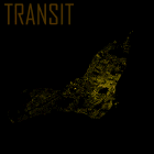
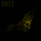
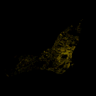
24 hours of traffic
See the streets of Montreal light up with the GPS traces of it's road users. See the behavior of automobiles, cyclists and public transit individually, and combined on a terrain elevation map of the greater Montréal area. This visualization combines open data from several sources.

If for some reason the Wix-hosted video isn't working properly, you can watch it on YouTube.
Zoomed-in and slowed down
24-hour gif loop

Animation of various traffic origins: off-island and individual borroughs
Credits and Acknowledgements:
All data processing and visualization was done by me: Tyler Sloan (@Quorumetrix).
Traffic data was obtained from the Montreal Open Data Portal, which was collected by users of the mtlTrajet smartphone application over a 1-month period in autumn of 2016.
For cycle trajectories, data from the monRésoVélo app was also included. The background elevation map was obtained from the Japan Aerospace Exploration Agency (JAXA). The positions of the buildings (shown to simulate a night-time aerial photo, was obtained from the Montreal Open Data Portal, and locations were cross referenced using the Nominatim Geocoder in the GeoPy Python package.
An extra special thanks to the contributors to Montreal Sound Map - I used this awesome site to source recording for the video.
A few caveats:
This is not a true snapshot of a 24h period, rather a visualization of 1-month of gps recordings, compressed into a 24h period, while maintaining the HH:MM metadata. Each frame represents 1 minute of real time. This is not and does not try to be a complete survey of commuter geolocation data, as such an open data source, to my knowledge, doesn't exist. The mtlTrajet dataset from the Montreal Open Data portal, though not a complete survey, is the largest publically available data source of it's kind.
See also:
static visualization gallery of Montréal maps
This is a gallery containing several different maps of Montréal generated using the mtlTrajet data. If you're interested to order a print of these, you can through the online store.

